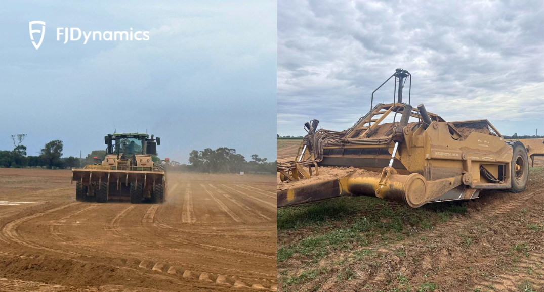
À Victoria, en Australie, le modelage de précision des terres va bien au-delà du simple nivellement — il constitue le fondement d'une gestion durable de l'eau. Récemment, Jimmy Humphris, un entrepreneur local de premier plan spécialisé dans les infrastructures d'irrigation, a déployé le Système de nivellement 3D FJD AL02 pour réaliser un projet très exigeant de 40 à 50 hectares. Opérant un puissant tracteur John Deere 9R 540 associé à une décapeuse, l'équipe de Jimmy a collaboré avec Ag Tech & Machine (dirigée par James Rover) pour intégrer une conception numérique de terrain de qualité professionnelle directement sur le terrain.
Avantage technique : Intégration transparente via le contrôle SCV d'origine
Pour les plateformes lourdes comme le tracteur John Deere 9R 540, l'intégration du système représente souvent un obstacle. Cependant, l'AL02 a fait preuve d'une compatibilité exceptionnelle en communiquant directement avec le SCV (Selective Control Valve) d'origine du tracteur.
En s'affranchissant du besoin de blocs de valves hydrauliques externes, l'AL02 a permis de :
- Contrôle hautement réactif : La communication électronique directe garantit que la décapeuse réagit instantanément aux changements de terrain.
- Installation propre et stable : L'absence de modifications hydrauliques intrusives se traduit par une fiabilité accrue et un habitacle plus ordonné.
- Exécution de précision : Gestion précise des fonctions de levage et d'inclinaison, même lors de la manipulation des charges massives d'un tracteur de la série 9R.
Flux de travail numérique : De la conception sur ordinateur à l'exécution sur le terrain
Un drainage scientifique nécessite une planification complexe. L'équipe technique d'Ag Tech & Machine a aidé à combler le fossé entre l'ingénierie professionnelle et l'opération sur le terrain grâce à un flux de travail numérique rationalisé :
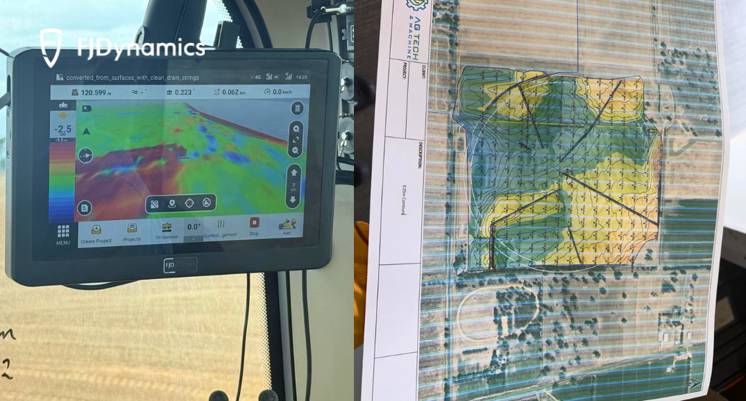
- Conception topographique : Les conceptions de drainage et de surface à taux variable ont été créées dans John Deere TerraCutta.
- Conversion de fichiers : L'équipe a exporté les conceptions sous forme de fichiers DXF et les a converties au format AGD compatible avec l'AL02.
- Importation directe : Les fichiers AGD ont été importés directement dans le terminal de contrôle de l'AL02, éliminant ainsi le besoin de mesures et de marquages manuels sur le terrain.
Cette approche « basée sur un modèle » garantit que le relief final est la reproduction fidèle à 100 % de la conception d'ingénierie, ce qui est crucial pour une efficacité hydrique à long terme.
Voix depuis la cabine : « Intuitif, intelligent et inégalé »
Après cette première journée d'opération à haute intensité, Jimmy Humphris et son équipe ont partagé plusieurs conclusions clés :
- Interface « zéro formation » : Les opérateurs ont été particulièrement impressionnés par l'interface utilisateur de l'AL02. Sa logique intuitive leur a permis de commencer à travailler avec précision presque immédiatement, ne nécessitant virtuellement aucune formation spécialisée.
- Modélisation avancée des pentes : « D'autres logiciels nous obligent souvent à diviser manuellement un champ en zones pour gérer les conceptions complexes à double pente », a fait remarquer l'équipe. « L'AL02 adapte la pente automatiquement et contrôle l'inclinaison de la lame de manière native, ce qui fait gagner un temps précieux. »
- Précision constante : Que ce soit en entrant dans une nouvelle zone ou en naviguant sur un terrain accidenté, le système a maintenu un contrôle stable, réduisant considérablement la fatigue liée aux ajustements manuels.
À propos du FJD AL02 : Niveler chaque centimètre, économiser chaque goutte
Le FJD AL02 est un système de nivelage 3D de nouvelle génération conçu pour les travaux de terrassement professionnels et l'optimisation du relief. En combinant le positionnement GNSS de haute précision avec des algorithmes de contrôle avancés, il aide les entrepreneurs à atteindre :
- 22 % d'économies d'eau : Les pentes optimisées garantissent que chaque goutte d'eau atteint la culture.
- 10 % de réduction de carburant : Une carte topographique plus intuitive et moins de passages signifient moins d'usure du tracteur et des coûts réduits.
- 40 % de gain d'efficacité : Le contrôle automatisé de la lame et la coordination multi-machines accélèrent l'achèvement des projets.
Compatibilité totale : L'AL02 prend en charge l'importation et l'exportation de fichiers de conception spécifiques à l'industrie, garantissant une intégration transparente dans votre écosystème d'ingénierie existant.
Conclusion
Ce déploiement démontre le potentiel du FJD AL02 dans les applications professionnelles de remodelage du terrain et de gestion de l'eau, en particulier dans les scénarios nécessitant une précision basée sur des modèles et une intégration transparente avec des systèmes de tracteurs de forte puissance.
Vous cherchez à améliorer la précision et l'efficacité de vos opérations de remodelage du terrain et de gestion de l'eau ? Découvrez comment le FJD AL02 permet un façonnage du terrain basé sur des modèles avec une intégration transparente de la machine et une performance fiable sur le terrain.