
CM-LevelAccuracy

Global Coverage

Stable Signal

Automatic Setup
Global Centimeter-Level Accuracy
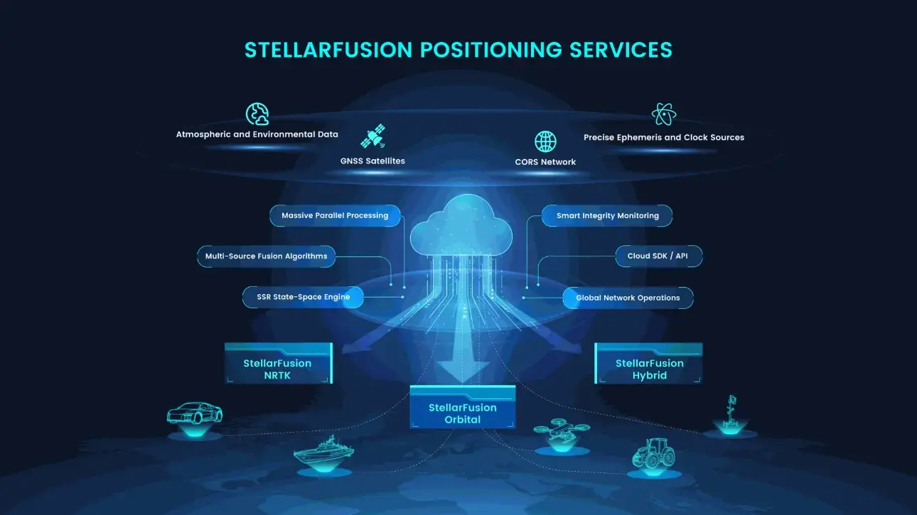
StellarFusion is a global high-precision positioning service platform built on next-generation state-space augmentation technology. Centered on multi-source GNSS data fusion algorithms and a cloud-based real-time state-space correction generation engine, the platform dynamically delivers network-based positioning services, satellite-based positioning services, and smart fusion positioning services.
Deliver fast-converging, centimeter-level positioning that works globally in any weather. With over 99.9% availability, it sets a new benchmark for precision—now trusted across more than 140 countries through a network of 3,500+ dealers—making it ideal for autonomous vehicles, drones, high-tech surveying, and IoT applications.
Fast Access, Flexible Plans
Work easily with common GNSS receivers and devices. You can get corrections quickly via NTRIP or satellite signals. With flexible subscription plans (yearly or daily), you only pay for accurate services when you need them, making it ideal for any size job, big or small.

Reliable Performance
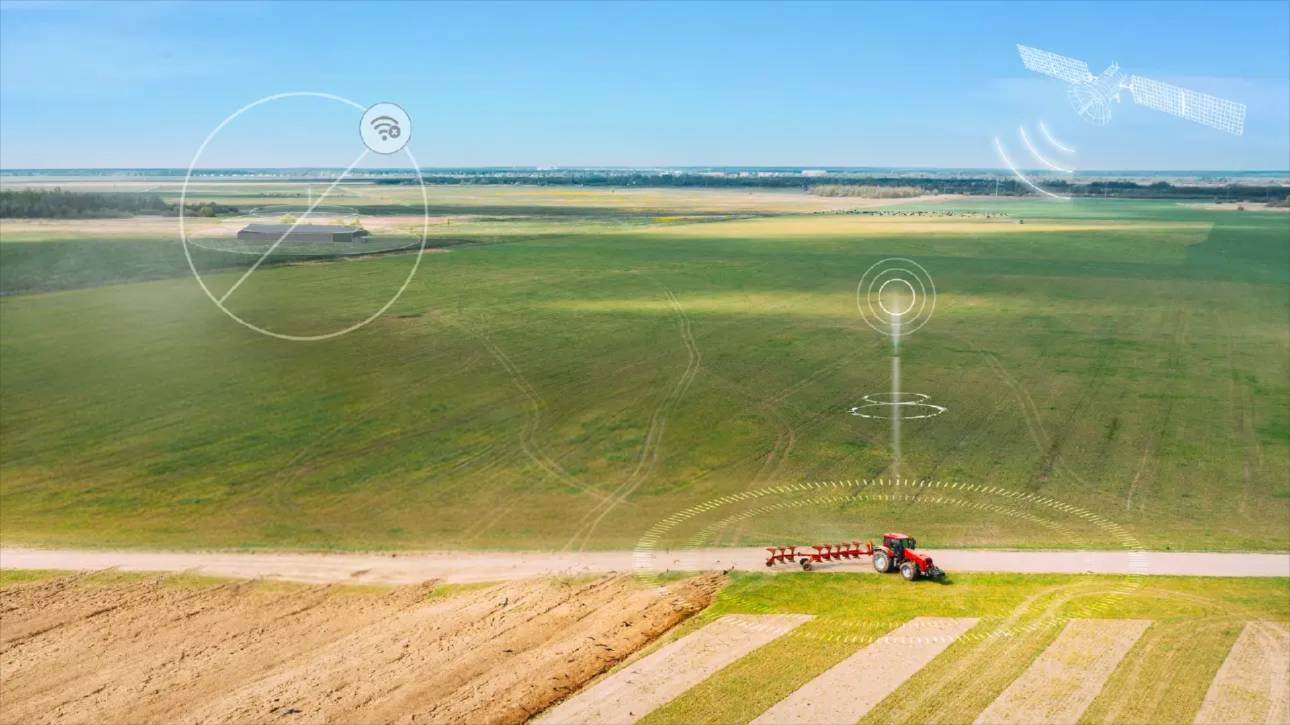
Stay stable using both network and satellite correction paths. StellarFusion performs reliably in suburban areas, weak-network regions, and even without network coverage, ensuring consistent positioning across a wide range of farming conditions.
Application Scenarios

Construction Machinery


Services | StellarFusion NRTK
Network-based cm-level positioning in real time
| StellarFusion Orbital
Global satellite signals for wide-area positioning
| StellarFusion Hybrid
A combo of network and satellites for reliable coverage
|
Positioning Accuracy | Horizontal < 2 cm, Vertical < 2.5 cm¹, Vertical < 5 cm | Horizontal: <3 cm; Vertical: <6 cm | Horizontal: <3 cm; Vertical: <6 cm |
Convergence Time | <3s | 3min-8min | <120s |
Supported GNSS | GPS / GLONASS / Galileo / BeiDou / QZSS | GPS / GLONASS / Galileo / BeiDou | GPS / GLONASS / Galileo / BeiDou |
Coordinate Frameworks | CGCS2000, WGS84, ITRF2008 | CGCS2000, WGS84, ITRF2020 | CGCS2000, WGS84, ITRF2020 |
Availability | ≥ 99.9% | ≥ 99.9% | ≥ 99.9% |
¹ When the distance between base stations is within 3 km, vertical accuracy (3σ) is within ±2.5 cm.
² Satellite-based services require support from specific hardware models
